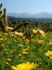
A beautiful description of Lake Ilmen. A natural monument is the southern shore of Lake Ilmen (Ilmensky Glint). One of the most beautiful places in Russia
Lake Ilmen is located in the northwest of the East European Plain. Ilmen is in the twelfth place in terms of area among the lakes of Russia.
There are many options for the origin of the name of the lake, and none of them can be considered definitively proven. In all ancient Russian sources known to science, the lake is referred to as Ilmer until the 16th century. It is widely believed that this name comes from the Finnish "ilm" (weather) and the Russian ending "-er", which together means "Lake that creates the weather." Since the middle of the XVI century. introduced modern form the name Ilmen, using the Proto-Slavic ending "-men".
Science assigns the role of a kind of "museum" to the lake and Priilmenye, which displays a series of long-term geological processes. 2.5 billion years ago, a deep fault formed here, along which volcanic eruptions occurred. In the Paleozoic, the basin of the future lake was flooded by the sea, and sediments accumulated on its bottom. In the Cenozoic, huge rivers appeared here, cutting through deep valleys. Modern rivers that feed Ilmen flow precisely through these valleys. At the same time, a lake also appeared: its depth reached hundreds of meters, and the area was many times larger. The lake was finally formed in its present form during the ice age, under the influence of ice layers.
The current Ilmen is a shallow swampy reservoir, with yellowish water, classified as “disappearing” as a result of silting and drifting by river sediments.
Ilmen is the only Russian body of water in which the level difference during the flood reaches 7 meters, and the mirror area triples at once. This is due to both the abundance of tributaries and the shallow water of the lake itself.
Representatives of different ethnic groups lived on the banks of the Ilmen: Baltics close to Lithuanians, Baltic Finns - Ests, Vods, Izhoras, Vepsians, Chuds.
Story
The first Slavs began to develop the banks of the Ilmen in the VIII-IX centuries, they also received the name Ilmen. Numerous archaeological monuments around the lake in the form of settlements and burial mounds have been preserved from them. In the settlement on the Volkhov (7th-8th centuries), the foundations of extensive wooden huts were found, which indicates that the Ilmen Slavs lived in large families, and iron coulters indicate developed agriculture in those places. Over time, the cities of Novgorod and Staraya Russa arose on the lands of the Ilmen Slavs, legends about the “calling of the Varangians” were mentioned in the chronicles, and Prince Oleg’s campaign against Tsargrad in 907 was described. The scattered settlements of the Ilmen Slavs laid the foundation for the Novgorod feudal republic. 
The significance of Lake Ilmen was very great in the old days: the famous route “from the Varangians to the Greeks” ran here: the water trade route of Kievan Rus, connecting Northern Rus' with Southern, and the Baltic states and Scandinavia with Byzantium. The path went from the Varangian (Baltic) Sea along the Neva to Lake Ladoga, then along the river. Volkhov to Ilmenskoye Lake, from there along the Lovat River, and further merchant dugout boats, which accommodated up to 40 people with goods, were dragged to the Dnieper.
For its size, Lake Ilmen received the name Slovenian Sea from the ancient Slavs. If you are in the geometric center of the lake, then it is impossible to see its shores, the lake surface is lost behind the horizon, and the effect of the sea creates the sound of the surf near the high southwestern shore, especially in strong winds. The only place on the entire lake where high shores have been preserved is the area of the village of Korostyn, where the height of the lake cliff reaches 15 m (Ilmensky Glint), from here you can observe even the most remote shores.
The ancient Slavs who lived on the banks of the Ilmen called it a "gold mine" for its rich fish stocks.
Today the lake is pretty shallow, but there are still a lot of fish in it. The reason lies in the fact that the flow of the lake, noticeable waves and shallow depth help saturate the water with oxygen. About 40 species of fish are found in the lake: pike, perch, pike perch, asp, catfish, bream, blue bream, silver bream, burbot, ide, roach, sabrefish, tench, ruff, smelt, bleak ... Both amateurs and whole artels of fishermen. Here and today you can see the original Ilmen soims lying on the sandy shore, whose design has not changed even a thousand years later: a flat-bottomed, deckless vessel with a small keel 15-18 m long and a pair of short masts. They were built on the southern bank of the Ilmen, in the village of Ustrik. It was on such a soyma that the epic merchant Sadko walked around Ilmen.
Previously, fishing was hampered by modern ships that sailed along Ilmen, but now there are very few of them left, and mostly these are tourist boats. The shores of the lake themselves are a historical landmark here: in these places, between the Yuriev Monastery and the village of Rakomo, in 1015 the first Novgorod veche was held.
The dense forests on the banks of the Ilmen are full of game, which became especially abundant after the industrial production, the population of workers' settlements has decreased and forest roads have become overgrown. The most common here are the fox, raccoon dog, hare, squirrel, ermine, beaver, muskrat, marten, mink. The population of brown bears, lynx, wolves, wild boars, roe deer and elks, which were on the verge of extinction, is growing. The system of dams and dams that regulated the river flow has fallen into decay, and in the swamps, the area of \u200b\u200bwhich has increased many times, now many geese, ducks, capercaillie, black grouse, hazel grouses, partridges, woodcocks, snipe, waders live.
On the river Volkhov has a hydroelectric power station, which since 1926 carefully controls the water level in the lake. This has to be done, since in the old days the peasants used the floodplains as water meadows, and the current inhabitants of these places planted gardens and kitchen gardens here, built houses. If a lot of water accumulates in the lakeside territories, water is dumped at the hydroelectric power station as much as is necessary for normal operation station, and the level goes down.
In the vicinity of the lake - two big cities: and competing with him in antiquity Staraya Russa. If the first was always a princely city, then the second got rich in salt works. Already in the XI century. it was a wealthy city. True, the desire to expand the extraction of salt led to the fact that all the surrounding oak forests were transferred to firewood, since the salt works required an excellent charcoal.
general information
Location: west of the Novgorod region of the Russian Federation.
Origin: glacial (near-glacial).
Water balance: waste.
Position: ground.
Mineralization: fresh.
Russian language.
Ethnic composition: Russians.
Currency unit: ruble.
Religion: Orthodoxy, atheism.
Major cities: Veliky Novgorod, Staraya Russa.
Major rivers: flow - Meta, Pola, Lovat with Polista, Shelon with Mshaga, Veronda, Veryazh and others (about 50 in total), follows - Volkhov.
It freezes in October-December, freezing in November-April.
Numbers
Minimum area: 733 km2.
Average area: 982 km2.
Maximum area: 2090 km2.
Average depth: 2.6 m
Max Depth: up to 10 m.
Length: 45 km.
Width: 35 km.
Catchment area: 67,200 km2.
Height above sea level: 18 m
Water volume: up to 12 km3.
Transparency: 0.51 m.
Coastal population: 634 135 people (2010).
Economy
Industry: woodworking, pulp and paper, food. Volkhovskaya HPP (R. Volkhov, Leningrad region, Volkhov).
Agriculture: crop production (potatoes, vegetables), animal husbandry (meat and dairy, poultry farming).
Fishing.
Service sector: tourism, transport.
Climate and weather
temperate continental.
Summer is not hot, spring is warm and long, winter is mild, autumn is cool and long.
January average temperature:-10°C.
July average temperature:+ 17.5°С.
Average water temperature in summer:+18 - +20°С.
Average annual rainfall: 550 mm.
Attractions
■ Novgorod State United Museum-Reserve;
■ Golino village (XIII century);
■ Detinets and Sigtuna gates (Veliky Novgorod, XV century);
■ Rurik's Settlement (Veliky Novgorod, IX century);
■ Monument "Millennium of Russia" (XIX century);
■ Religious buildings: St. Sophia Cathedral (Veliky Novgorod, XI century), Yuriev Monastery (Veliky Novgorod, XII century), Transfiguration Cathedral (Staraya Russa, XII century), Church of the Great Martyr Mina (Staraya Russa, XIV century) , St. George's Church (Staraya Russa, XV century), Church of the Assumption Holy Mother of God(village Korosten, 18th century). Resurrection Cathedral (from Buregi, XVIII century), St. Nicholas Church (village of Buregi, XVIII century), Church of the Transfiguration of the Savior (village of Gostezh, XVIII century);
■ Novgorod Museum of Folk wooden architecture Vitoslavlitsy (Veliky Novgorod);
■ House Museum of F. M. Dostoevsky (Staraya Russa).
Curious facts
■ In the XIX century. a resort was created on the salt springs of Staraya Russa. In order to attract holidaymakers here, in 1878 the St. Petersburg merchant Vargunin built a private narrow-gauge railway Novgorod - Shimsk - Staraya Russa. Later converted to a regular track, the road operated up to the Great Patriotic War when it was destroyed and remained unrepaired.
■ In the last century, the following phenomenon was observed on Lake Ilmen: bacteria living in the lake and processing rotting algae and peat simultaneously emitted combustible gas. IN winter time fishermen used this: they punched a hole in the lake, set fire to the released gas, boiled water on it and cooked fish soup. At present, this phenomenon is no longer observed.
■ In the vicinity of Ilmen there are several stones-saedoviks: cult stones of the ancient peoples who lived on the shores of the lake. There are images on the stones, the meaning of which has been lost. Each stone has its own name (for example, "Elesina Mother of God"), and they are considered healing, because they supposedly help get rid of various ailments.
■ Ancient chronicles have repeatedly described strange phenomenon, when the Volkhov River flowed backwards, or, as they wrote then, “on the vzvode”.
In 1176 this phenomenon lasted five consecutive days. This is explained by the backwater flow of the Volkhov by the waters of its tributaries, when the water level in Ilmen is extremely low.
■ On July 14, 1471, on the left bank of the Shelon River, which flows into Lake Ilmen, the historic Battle of Shelon took place between the Moscow army of voivode Daniil Kholmsky and the Novgorod militia under the command of Dmitry Boretsky, the son of Martha Posadnitsa. Novgorodians were defeated, the Novgorod Republic ceased to exist, Novgorod became part of Muscovy.
■ Staraya Russa is in second place (after Novgorod) in terms of the number of birch bark letters found: 45 samples.
■ Ilmensky Glint - a cliff about 8 km long and up to 15 m high between the villages of Korostyn and Pustosh. It contains a lot of geological data, being the longest exposed formation of the Devonian period on the Russian Plain. Since 2001 - in the list of specially protected natural areas. The underground karst river Poneretka in the Borovichi district of the Novgorod region is the left tributary of the Meta, which flows into Lake Ilmen. - a unique monument of nature: it flows underground until it flows into the Meta for almost two kilometers.
■ Lake Ilmen is part of the Vyshnevolotsk water system: the oldest artificial water system in Russia. In 1703, Tsar Peter I signed a decree on the construction of the first canal of the system, which later connected the city
Lake Ilmen is located in the western part of the Novgorod region. Scientists attribute the reservoir to the Baltic Sea basin.
The history of the lake and its environs is rich, interesting and mysterious. This is due to the fact that the lake has been shrouded in legends, myths, and secrets since ancient times.
Origin of Lake Ilmen
A reservoir was formed almost 2.5 thousand years ago, due to the fact that in this place, after the retreat of the glacier, a break in the earth's crust occurred.
Lake Ilmen on the map

Historical events
The banks of the Ilmen were inhabited a very long time ago, but scientists have not been able to establish the name of the tribe / nationality / ethnic group for sure. Archaeologists have found traces of the Ural and Finnish ethnic groups, which were then forced out by the Slavs. It is possible that representatives of the Scandinavian and Germanic tribes lived here.
Historical chronicles testify that on Lake Ilmen on July 7, 1471, Prince Danilo Kholmsky of Tver, who was in the service of the Moscow Tsar, defeated the army of Veliky Novgorod. Three weeks later, a peaceful Moscow-Novgorod treaty was signed here.
Which rivers flow into Lake Ilmen
Almost 50 rivers flow into the Ilmen - both large and small. Among the biggest it is worth noting:
- Veryazh;
- Veronda;
- Mstu;
- Lovat;
- Shelokhon;
- Mshagu.
But only one river flows out of the lake, which is called the Volkhov. It is this river that connects Lake Ladoga with Lake Ilmen.
Relief
The shores of the lake are distinguished by a large number of wetlands and lowlands. Along the coast you can find deltas, channels, flat floodplain islands. Most of all swamps and swamps are near the eastern and southeastern shores. Depressions and ridges predominate in the north and northwest.
Cities
The closest to the lake is the city of Veliky Novgorod, from where excursions around Ilmen are regularly carried out. 90 km from Veliky Novgorod there is a settlement called Staraya Russa. The city belongs to the basin of the reservoir, and is connected with the Ilmen lake by historical and cultural ties.
Animal world
Lake fauna represented different types fish. Most of all, there are such river inhabitants as pike, burbot, smelt, bream, perch, sabrefish, etc., whitefish is rarely found. There were more of this fish, but after the Volkhovskaya hydroelectric power station was built, the whitefish population decreased sharply.
 lake Ilmen. sunset photo
On the shores of Lake Ilmen there is a huge number of insects, which is associated with wetlands and coastal areas, high humidity. There are especially many here blood-sucking insects, among which it is worth noting gadflies, mosquitoes, horseflies, midges.
Many birds that nest are mallards, crake and many others. Otters live, which are listed in the Red Book.
Characteristics of Lake Ilmen
- The area of the lake during the flood is 2,230 km2, when the water subsides, then the area is reduced by almost four times and is 660 km2. The average area is equal to 1 thousand km2;
- The length of the lake is 45 km, and the width reaches 35 kilometers, the depth varies from 10 to 13 meters;
- The Ilmenskoye Lake is fed by rivers in the spring, when they overflow with floods, in winter the low water is responsible for the "nutrition";
- The water level fluctuates within 7.4 meters, reaching a maximum in May, and a minimum in March;
- Between November and April, the lake is frozen over;
- The water in the lake contains a large amount organic matter(mostly peat), which is why the color of the water has a yellow or brown tint. But organic elements do not affect the purity of water. Once every one and a half to two months, the water is renewed in the reservoir;
- In summer, the water temperature in the lake exceeds +20 C, which is why the water near the shores constantly “blooms”;
- A feature of Ilmen are storms that cause the formation of high, but short, waves;
- The height above sea level is 18.1 m;
- The climate is temperate continental;
- The average annual rainfall is 550mm;
- Characteristic of the lake are the processes of siltation, the drift of river sediments, due to which the lake begins to gradually disappear under such a “veil”.
- In the times of Kievan Rus, the lake was part of the famous trade route “from the Varangians to the Greeks”;
- The epic name of Ilmen is Sadko Lake, and in the Middle Ages the reservoir was called the Slovenian Sea - because of the boundlessness and the unique system of water spills;
- On the southern bank of the Ilmen there is the so-called Ilmensky Glint - this is a cliff-ledge. Its height is 15 m, and its length is 8 km, occupying the territory between two villages - Pustosh and Korostyn. In the limestone that makes up Glint, geologists have found many marine fossils dating back to the Devon period. Here they were discovered mineral springs and very rare plant species.
Name
Of the scientific etymologies of the name of the lake, the version about the origin of the other Russian is the most popular. Ilmen, Ilmer from fin. Ilma-järvi "lake of (un)weather, heavenly lake".
Physical and geographical characteristics
The area of the lake, depending on the water level, varies from 733 to 2090 km² (with an average level of 982 km²); length about 45 km, width up to 35 km; depth up to 10 m. The shores are mostly low-lying, swampy, in some places - deltaic, with many flat floodplain islands and channels; ridges are stretched along the northwestern coast, alternating with depressions; swampy in the southeast and east.
About 50 rivers flow into Lake Ilmen. The largest of them are: Msta, Pola, Lovat with Polist, Shelon with Mshaga, Veronda, Veryazh, etc. The only river Volkhov flows out of Lake Ilmen, flowing into Lake Ladoga. The main food of the lake is carried out due to the inflow of rivers with spring floods and winter low water. Level fluctuations up to 7.4 m (minimum - in March, maximum - in May). Freeze from November to April.
Geological history
Ilmen and Priilmenye are important indicators of geological processes in the North-West of Russia. Back in the Archean era, about 2.5 billion years ago, a rigid foundation of the East European Platform was formed (due to the drift of the continents, this platform began its journey in the southern hemisphere), represented by crystalline rocks (shales, granites, gneisses). In the Priilmenye region, they do not come to the surface anywhere, lying at a depth of 600 to 2000 m and are found in deep wells in the districts of Novgorod, Valdai, Pestovo, the village of Kresttsy and some others. The surface of the crystalline foundation is inhomogeneous. Under the influence of the internal forces of the Earth, the so-called Kresttsovsky fault was formed (the cavities are convenient for gas storage facilities), which ran from the northeast to the southwest in the area of the modern village of Kresttsy. In the Proterozoic era, along the line of the Kresttsovsky fault, volcanic rocks erupted: diabases, tuffites and others.
Palaeozoic
At the beginning of the Paleozoic era, when the surface was lowered, the region of the future Lake Ilmen and its basin was flooded by the sea. Then, under the influence of the internal forces of the planet, the surface rose, and the sea receded. Further, the surface of the Priilmenye was repeatedly lowered and flooded by the sea. Sands, silt, shells, skeletons of fish and marine animals settled to the bottom. Over millions of years, these marine deposits have turned into limestones, marls, sandstones. Gradually, the sea became shallow, land areas, islands, sea bays, lagoons (lakes separated from the sea by land areas) appeared.
In the middle of the Paleozoic era, there was a hot and humid climate, which contributed to the development of rich and diverse vegetation in the region. From the plant remains of this time, layers were formed brown coal. The new advance of the sea contributed to the formation of a layer of limestone lying on top of the coal-bearing strata characteristic of the Nebolchi - Lyubytino - Valdai strip.
By the end of the Paleozoic era (about 200 million years ago), the sea finally retreated from the territory of the region. First it happened in the western part of the region, and then in the eastern part. And on the site of the Priilmenskaya lowland for many millions of years there was a hill, and on the site of the modern Valdai Upland - a lowland. The western upland (in the vicinity of the future lake) was severely destroyed by rivers, they completely washed away the surface strata of rocks.
Cenozoic era
Only at the beginning of the Cenozoic era (less than 70 million years ago) did the eastern part of the region rise. Compared to the western regions, it rose by 100-200 m. Rivers began to form on the hill, which developed deep valleys. Many modern rivers (Msta, Polomet, Kholova and others) flow in the ancient valleys that formed at that time and lead to the pre-glacial Ilmen (this state of it is just beginning to be modeled and studied).
The Priilmenskaya lowland and the Valdai Upland were formed in the Cenozoic era, even before the onset of glaciers.
The lowland that appeared in the west of the region was composed mainly of loose, variegated sandy-clayey rocks and marls. The elevated plateau in the east consisted of hard limestones and dense clays. To the west, towards the lowland, even before the Pleistocene, the plateau was cut off by a ledge. In some places, this ledge (Valdai) is expressed in modern relief. For millions of years, it separates the Valdai Upland (with post-glacial sediments) from the Priilmenskaya Lowland. Ancient Paleozoic deposits lie relatively shallow and often come to the surface along the banks of rivers and lakes.
Lake Ilmen, which received the rivers of the Cenozoic times, sometimes reached a depth of tens of meters and was ten times larger in area than the current one.
One of the main events of the last million years (Pleistocene) is the advance of glaciers on the East European Plain. The most important for the Novgorod region was the last, so-called Valdai glaciation 70 - 15 thousand years ago. The glacier left a thick layer of moraine deposits: loam, sand and sandy loam. The material of the moraine is highly mixed and contains many boulders of crystalline rocks brought by ice from the north.
The relief of the region is characterized by moraine deposits in the form of hills. Large moraine hills have a relative height of 50 - 60 m, medium - 10 - 30 m, small - 5 -10 m. Sometimes, among the hilly moraine relief, there are relatively flat areas composed of boulder loam. These are moraine plains. They predominate on the Priilmenskaya lowland in the vicinity of Lake Ilmen.
Ilmensky Kamy
During the Pleistocene, the Priilmenskaya lowland experienced a number of significant changes.
Intraglacial lakes often arose here, now more often represented by kams - randomly located hills with steep slopes and often flat tops, which are also known in the vicinity of Lake Ilmen. Such lakes appeared in cracks and other voids of immobile ice massifs and were limited to ice shores and sometimes ice vaults. They deposited detrital material in sorted form, brought by streams of melt water. After the disappearance of the ice, the prisms, formed from pebbles, sand, clay, descended to the bottom of the former glacier and took characteristic forms Kamov. Individual sizes Kams are limited: the height is up to 50-80 m, the width of the sole is up to 0.5-1.0 km. From the above data, it follows that the lakes in which the future kames were formed had small size. The duration of their existence was short and, apparently, limited to tens or first hundreds of years.
The shape of the kams is predominantly round, but there are also formations with complex outlines. Often kams are grouped in the form of extensive complexes, forming a kind of kame landscape. Kamas are composed of sorted sands, sandy loams, clays, gravel. For them, (horizontal and diagonal) layering is usually noted, often of the ribbon (lake) type. Kamas with a core of ribbon clays are known. There are cases of layering deformation caused by the movements of glacial masses that have taken place. Kams are often covered by a moraine cover formed by boulder loams and sandy loams. Bronnitskaya Gora is sometimes recognized as one of the examples of kams, although the artificial nature of at least part of this huge thirty-meter hill, hundreds of meters in circumference, is not excluded.
Origin
Ilmen belongs to the third group of lakes of the glaciation periods. These lakes were formed and located at the outer edge of the ice sheets. The generally accepted name for reservoirs of this type is glacial lakes. Of all the groups of lakes of the glacial epochs, the periglacial lakes are among the most studied. They occupied depressions in the terrain, and the ice edge played the role of a dam that prevented the flow of melt water in accordance with the natural slope of the territory.
| Lake | Square surfaces water, km² |
Volume, km³ |
Location- position (a country) |
|---|---|---|---|
| Ladoga | 17700 | 908 | Russia |
| Onega | 9720 | 285 | Russia |
| Venern | 5550 | 180 | Sweden |
| Chudsko- Pskov |
3550 | 25,2 | Russia Estonia |
| Vättern | 1900 | 72 | Sweden |
| saima | 1800 | 36 | Finland |
| White | 1290 | 5,2 | Russia |
| Vygozero | 1140 | 7,1 | Russia |
| Mälaren | 1140 | 10,0 | Sweden |
| Päijanne | 1065 | ... | Finland |
| Ilmen | 1200 | 12,0 | Russia |
| Inari | 1000 | 28,0 | Finland |
The runoff came from areas of the lake remote from the edge of the glacier. Near-glacial lakes did not always appear. Necessary condition for their appearance and existence, it turned out that there was a watershed at some distance from the outer edge of the ice sheet, which is indicated by the rivers flowing into the Ilmen. If the ice sheet crossed the watershed, then the lakes could not appear. The glacier served as one of the shores, and the water body of the lake turned out to be located between the icy one, on the one hand, and the land shores, on the other. These were migratory water bodies. When a glacier advanced, the glacial lakes moved in front of its front, flooding all new land areas. When the ice cover retreated, such lakes migrated after it. Due to the peculiarities of the dynamics of the borders of the near-glacial lakes, their terrestrial shores could be located far beyond the ice massifs. Therefore, the nature of the deposits marking the disappeared near-glacial lakes in their different parts may differ, which is taken into account in the reconstruction of these lakes. water bodies. Near-glacial lakes often had significant depths, which depended on the magnitude of the backwater created by the ice sheet and watershed marks, which determined the height of the threshold for the flow of water masses. During the formation of near-glacial lakes in areas with a smooth relief of the territory, areas with maximum depths could be located in areas adjacent to the glacial edge. The general slope of the bottom was oriented in the same direction. In those cases when such reservoirs covered large tectonic depressions, places with the greatest depths could be far from the ice edge. Accounting for the depths and features of their location is essential for understanding the formation of bottom sediments, the analysis of which ensures the identification of paleolakes. The duration of the existence of near-glacial lakes is commensurate with the duration of individual glaciations. During the period of the Valdai glaciation, the possible duration of the existence of water bodies of this type associated with it (taking into account the continuous change in location and shape due to the dynamics of the ice cover in space) could not exceed 70-65 thousand years or 120-105 thousand years, depending on accepted time of the beginning of glaciation. After the disappearance of the glacial lakes, the following remained in their place:
- vast expanses already devoid of very large lakes;
- territories saturated with a large number of basins, currently occupied by medium and small lakes;
- shallow and deep-water basins of various areas, in which large and largest lakes were formed (Ilmen, Beloe, Vozhe, Lacha, Ladoga, Onega, Pskov-Chudskoe, Vyrtsyarv, etc.).
Geological studies say that in the first post-glacial time, on the site of Lake Ilmen, there was a vast reservoir with depths of up to 30 meters (with backwater in the vicinity of the village of Gruzino near Chudovo), later its basin was 90% filled with river deposits. The breakthrough of the Volkhov and the discharge of the Georgian Lake into Ladoga occurred about 6 thousand years ago.
Our days
Now Ilmen is a “dying” reservoir, disappearing under the influence of centuries-old processes of silting and drifting of its bed with river sediments.
The historical significance of Priilmenye
ethnic traces initial settlement the shores of Lake Ilmen and the economic use of the lake and its environs dates back to Nostratic times, which have not yet been properly studied. Old Finnish bindings dominate, which meet more and more archaeological and geno-ethnic objections. It is possible that the Priilmenye region was visited by people during the Mikulin interglacial period (more than 75 thousand years ago) and during periods of temporary retreat of the Valdai glacier (about 35 - 30 thousand years ago).
At the beginning of the Holocene, the level of Lake Ilmen reached 32 meters or more, so all the banks below this mark (especially in the area of the future Novgorod) were flooded. Then the level dropped by a dozen meters, but during the period of the climatic optimum it again rose to about 28 meters. Then the pressure of water broke through the barriers between Ilmen-Volkhovskoye Lake and Gruzinskoye Lake, jumpers were overcome in the Pchevzhi area and the lower reaches of the Volkhov (rapids formed there). Already about 5 thousand years ago, the water level allowed for the possibility of settling the Priilmenye, which is what archaeologists note.
Traces of the Neolithic were found in ten places relatively close to the source of the Volkhov from Lake Ilmen: Kholopy town, Robeika, Rurikovo settlement, Kolomtsy, Strelka, Prosty, Rakomo, Vasilyevsky, Goroshkovo, Erunovo. In this era, the settlement of the Southern Priilmenye also begins.
The pre-Baltic-Finnish toponymy (generally attributed as "Old Finnish") was probably left by the Ural ethnic groups before the appearance of the Baltic Finns in the North-West. Sometimes it is defined as East Finnish (Mari). This includes hydronyms in -ma, -ksa, -ksha (Kitma, Koloshka, Koloksha), which have wide parallels in other early languages. The question of the attribution of this toponymic stratum is very complicated, and has not been resolved by the Finno-Ugric scholars themselves. The relationship of pre-Baltic-Finnish names to archaeological cultures is unclear, their chronological depth is unclear, etc. Here the Nostratic version has more and more advantages.
The Baltic-Finnish toponymy is associated with the ethnogenesis of the Baltic Finns, from the beginning of the 2nd millennium BC. e., respectively, this stratum is chronologized approximately by this time. This is the most prominent toponymic substrate layer in the Northwest, especially in Obonezhie and Ladoga. In Priilmenye, the identification of the archaic Baltic-Finnish layer is difficult because the toponyms that form it are very strongly transformed by Slavic dialects. Differentiating a generalized Baltic-Finnish stratum into individual dialects is a practically difficult task. In the east of the region under study, the names retain more indications of the language of the ancestors of the Karelians, and to the north and west of the lake. Ilmen - the language of the ancestors of Estonians. The Baltic-Finnish hydronymy includes the names of rivers and lakes in -dro, -er, -der, -vzha, -zha, -os, -us, -ui, -oga, -oy, -la, and so on (the allocation of determinants is indicative ). The question of separating the ancient Baltic-Finnish toponymy and the Karelian toponymy that appeared here from the 17th century is difficult. (mostly "micronames": Chavra Gora, Lambushka, Gabo Grove).
V. L. Vasiliev in the Ilmen region identified a layer of “ancient European” hydronymy (according to the terminology of H. Krae). The researcher refers to this layer such names of rivers as Vavol, Vishera, Volkhov, Marevka, Oltechko, Omititsa, Udina, Paula (also Polist, Polona), Seremukha etc. This hydronymic layer dates back to the 2nd millennium BC. e. and is associated with the tribes of the Fatyanovo archaeological culture. The latter, in turn, are identified by researchers as Western Indo-Europeans, representatives of the not yet disintegrated Balto-Slavic-Germanic community (in the case of Priilmenye, proto-Balts).
Actually, the ancient Baltic toponymy, which has direct reflections in the Baltic ethno-linguistic area, etymologized on the basis of the Lithuanian, Latvian, Prussian languages, is indicated in a significant amount in the Ilmen and Volkhov regions. In this territory, it is almost not studied, it was considered partially. This group may include the names of lakes Dolzhino and Shlino, the Osma river, streams Vorolyanka, Stabenka, Burga and others.
Old Norse (North Germanic) toponymy is associated with the Scandinavians (according to the annals - "Varangians"). According to some versions, they appeared in Priilmenye almost simultaneously with the Slavs or a little later - at the end of the 1st millennium AD. e. There are many archaeological antiquities of the Scandinavians here, there are traces of the Scandinavian language in the ancient Novgorod anthroponymicon, however, there are either very few names of the Old Norse type in Priilmenye (the village of Buregi, the river Veryazh and some others), or they are unrecognizably distorted by Russian leveling influence. Be that as it may, toponyms will partly allow clarifying the debatable questions about the contribution of the Scandinavians to the creation of the statehood of Upper Rus', about the likelihood of Scandinavian rural colonization of the region under study.
Archaic Slavic toponymy is represented by a significant layer of names of the Priilmenye, dating from about the middle of the 1st millennium AD. e. until the 14th century The names that make it up are attributed according to various features, including elements of word-formation: -yn, -yn, -yn (the village of Korostyn, the village of Volyn), -itsa, -ichi, -ya (the rivers Dobritsa, Borovichi, Yarynya) and so on; suffix-inflectional method of formation (Schadro, Glino, Luko oz., Luka r.), archaic composites (Kholmatuzha, Zhylotug), formations from pre-Christian names, ancient nicknames using “iot” suffixation (villages Vidogoshch, Mirogoshcha, Rashucha), formations from ancient, obsolete or extinct appellatives (village Demyansk, v. Vodose, lake Peretno, brook Eglino), archaic phonetic transformations (village Prikhon, brook Iglino).
Properly Russian ("background") polyethnic toponymy refers to the XIII-XIV centuries, when the language of the Great Russian people was formed. Archaic models of derivation are becoming a thing of the past (for example, “iot” suffixing, two-basic personal names are disappearing), but the models of modern types are gaining productivity; general typology changes settlements and their names (for example, villages with names in -ovo, -evo, -ino appear en masse), the share of Christian personal names in toponymy increases sharply, and so on.
The further history of the Ilmenye, partly reflected in the work of V. Ya. Konetsky and E. N. Nosov, requires taking into account the data of Ptolemy and other information about the ancient and early medieval development of the Novgorod land.
Further historical significance (starting from the ice age) is associated with the events in Veliky Novgorod and Novgorod land up to the present.
The history of the study of Lake Ilmen
The first settlers laid the foundation for the study and economic development of the lake and its surroundings several thousand years ago. They partly concentrated their knowledge in epic, legends and epics. Ilmer turned out to be a "weathermaker" for the ancestors of the Finns and Ilmen (the god Il) for the Indo-Europeans, including the Slavs. According to the Tale of Slovene and Rus, the lake was originally called Moisko (probably by Nostratic communities), and Sloven and Rus changed the name to Ilmer - after the name of their sister (approximately like Lybid in the chronicle legends about Kiya). The name of Ilmera (Ilmeny) is played up in the epics about Sadko, and more often Ilmen-lake appears as the possession of the sea king.
How Sadko went to Ilmen Lake,
Sat down on a white combustible stone
And he began to play guselki yarovchata.
How then in the lake the water stirred,
The king of the sea appeared
I left Ilmeni from the lake,He himself said these words:
- Oh, you, Sadko Novgorod!
I don't know how to welcome you
For your joys for the great ones,
For your gentle game:
Al countless gold treasury?
Otherwise, go to Novgorod
And hit the big bet
Lay your wild head
And get rid of other merchants
Red goods stalls
And argue that in Ilmen Lake
There is a fish - gold feathers.
The medieval development of the lake itself and the Priilmenye is reflected in various ways in many works related to the study of the paths “from the Varangians to the Greeks” and “from the Varangians to the Persians”, with various aspects of the life of the surrounding population.
A whole galaxy of scientists of the XVII-XIX centuries. especially studied the southwestern shore of the lake, where the glint is located.
“First of all, it must be said that the layers of limestone look very beautiful due to their completely exceptional location: they lie horizontally relative to each other and look like a wall built by nature.”
He then attributed all these most beautiful outcrops to rocks deposited in the conditions of the sea, which existed in a distant geological era.
Nowadays, the achievements of many researchers are noticeable in the study of the lake: N. N. Davydova, P. F. Domracheva, D. D. Kvasov, L. A. Kudersky, I. F. Pravdin, D. A. Subetto.
Bacteria living in the lake, when processing rotting algae and peat, produce combustible gas. In winter, fishermen take advantage of this by digging a hole in the lake and setting fire to the escaping gas. On this fire you can boil water, cook fish or just keep warm. Currently, there are no such cases.
Notes
- Text "Tales of Slovene and Rus and the city of Slovensk"
- Fasmer M. Etymological dictionary of the Russian language. T. II. S. 128.
- Otkupshchikov Yu. V. Indo-European suffix *-men-/*-mōn- in Slavic place names // Otkupshchikov Yu. V. From the history of Indo-European word formation. St. Petersburg: St. Petersburg State University, 2005. S. 243-261.
- Geography of the Novgorod region
- History of the Pleistocene lakes of the East European Plain / Ed.: V. I. Khomutova (responsible editor) and others - St. Petersburg. : Science: St. Petersburg. ed. Firma, 1998. - 403 p. - ISBN 5-02-024848-7
- Kudersky L. A. Limnogenesis during the epochs of global ice sheets.
- Atlas of the oceans. Terms, concepts, reference tables. - M .: GUNK MO USSR, 1980. - P. 140-147.
- Priilmenye - the origins of Slovensk-Novgorod: places, languages, ethnic groups ...
- Bylinskiy E. N. The effect of lowering the levels of the Ilmenskoe and Ladoga lakes on the development of the longitudinal profiles of the tributaries of the lake. Ilmen and Volkhov. - Vestnik Mosk. un-ta, ser. Biol., soil science, geol., geogr. - 1959. - No. 3.
- Geology of the Cenozoic of the north of the European part of the USSR: Sat. articles / Ed. A. I. Popova, V. S. Enokyan. - M .: Publishing House of Moscow. un-ta, 1966. - 262 p.
- Rukoyatkin A. A. Structural and geomorphological analysis using aerial photography materials to identify local structures: (On the example of the North-West of the Russian Plain): Abstract of the thesis. dis. … cand. gegr. Sciences. - L., 1973. - 24 p.
- Subetto D. A. Lacustrine sedimentogenesis in the North of the European part of Russia in the late Pleistocene and Holocene: Abstract of the thesis. dis. … Dr. geol. Sciences. - St. Petersburg. , 2003. - 38 p.
- Subetto D. A., Davydova N. N. Paleolimnology of Lake Ilmen // Security and rational use water resources of Lake Ladoga and other large lakes: Tr. / Intern. sympos. on Lake Ladoga, 4th. - St. Petersburg. , 2003. - S. 260-264.
- Map (medium depths)
- Encyclopedic Dictionary of Brockhaus and Efron
- Mukhortova N. L. Development of the Priilmensky lake landscape in the Holocene
- Konetsky V. Ya., Nosov E.N. Mysteries of the Novgorod region. - L. : Lenizdat, 1985. - 120 p.
- Pylaev V. A. Starorussky Krai: Nature and population / Ed. ed. D. O. Svyatsky. - Novgorod: Novgorod. state typ., 1929. - 129 p.
- Ageeva R. A. Hydronymy of the Russian North-West as a source of cultural and historical information / Ed. ed. N. I. Tolstoy. - 2nd ed., Rev. - M .: URSS, 2004. - 252 p. - ISBN 5-354-00862-X
- V. L. Vasiliev Ethnolinguistic map of Priilmenye according to toponymy
Essay on geography, grade 8
Ilmen is a lake in the western part of the Novgorod region. Refers to the Baltic Sea basin of the Atlantic Ocean. A post-glacial reservoir (on the site of earlier water systems) with picturesque shores and a multi-thousand-year history of development. Traditionally attractive for Russian and foreign tourists.
The area of the lake, depending on the water level, varies from 733 to 2090 km² (with an average level of 982 km²); length about 45 km, width up to 35 km; depth up to 10 m. The shores are mostly low-lying, swampy, in some places - deltaic, with many flat floodplain islands and channels; ridges are stretched along the northwestern coast, alternating with depressions; swampy in the southeast and east.
About 50 rivers flow into Lake Ilmen. The largest of them are: Msta, Pola, Lovat with Polista, Shelon with Mshaga, Veronda, Veryazh, etc. The only river Volkhov flows out of Lake Ilmen and flows into Lake Ladoga. The main food of the lake is carried out due to the inflow of rivers with spring floods and winter low water. Level fluctuations up to 7.4 m (minimum - in March, maximum - in May). Freeze from November to April.
At the beginning of the Paleozoic era, when the surface was lowered, the region of the future Lake Ilmen and its basin was flooded by the sea. Then, under the influence of the internal forces of the planet, the surface rose, and the sea receded. Further, the surface of the Priilmenye was repeatedly lowered and flooded by the sea. Sands, silt, shells, skeletons of fish and marine animals settled to the bottom. Over millions of years, these marine deposits have turned into limestones, marls, sandstones. Gradually, the sea became shallow, land areas, islands, sea bays, lagoons appeared.
One of the main events of the last million years is the advance of glaciers on the East European Plain. The most important for the Novgorod region was the last, so-called Valdai glaciation 70 - 15 thousand years ago. The glacier left a thick layer of moraine deposits: loam, sand and sandy loam. The material of the moraine is highly mixed and contains many boulders of crystalline rocks brought by ice from the north.
The relief of the region is characterized by moraine deposits in the form of hills. Large moraine hills have a relative height of 50 - 60 m, medium - 10 - 30 m, small - 5 -10 m. Sometimes, among the hilly moraine relief, there are relatively flat areas composed of boulder loam. These are moraine plains. They prevail on the Priilmenskaya lowland in the vicinity of Lake Ilmen.
Now Ilmen is a “dying” body of water, disappearing under the influence of centuries-old processes of silting and drifting of its bed with river sediments.

The first settlers laid the foundation for the study and economic development of the lake and its surroundings several thousand years ago. They partly concentrated their knowledge in epic, legends and epics. Ilmer turned out to be a "weathermaker" for the ancestors of the Finns and Ilmen (the god Il) for the Indo-Europeans, including the Slavs. According to the Tale of Slovene and Rus, the lake was originally called Moisko (probably by Nostratic communities), and Sloven and Rus changed the name to Ilmer - after the name of their sister (approximately like Lybid in the chronicle legends about Kiya). The name of Ilmera (Ilmeny) is played up in the epics about Sadko, and more often Ilmen-lake appears as the possession of the sea king.
The medieval development of the lake itself and the Priilmenye is reflected in various ways in many works related to the study of the paths “from the Varangians to the Greeks” and “from the Varangians to the Persians”, with various aspects of the life of the surrounding population.
A comprehensive geographical study of the North-West and the Priilmenskaya lowland interested Lomonosov. On his initiative, expeditions were organized in 1768-1774 Russian Academy Sciences, which was attended by many prominent scientists.
Bacteria living in the lake, when processing rotting algae and peat, produce combustible gas. In winter, fishermen take advantage of this by digging a hole in the lake and setting fire to the escaping gas. On this fire you can boil water, cook fish or just keep warm. Currently, there are no such cases.

What secrets does the mysterious reservoir hide?
There are many places in Russia that fascinate not only with their beauty, but also with mystery. These include Lake Ilmen, which attracts thousands of admirers of everything mysterious and inexplicable. What are the legends about the lake?
Ilmen is a lake located in the Novgorod region, not far from the borders with Pskov and Tver. This reservoir is unique in nature, it has the largest water level difference in Russia during a flood - about 7 meters. When the lake floods in spring, its surface area almost doubles. At the same time, the reservoir itself cannot be called small - its dimensions at an average water level are 47 kilometers long and 38 kilometers wide.
Ilmen is one of those lakes about which there are a lot of legends and myths. We will talk about the most famous of them further.
Legends about the origin of the name of Lake Ilmen
There is still no unequivocal answer about how the name of Lake Ilmen appeared. According to one version, it is rooted in the Finno-Ugric languages, where Ilmeri means "sky" or "heavenly forces". According to another point of view, the lake got its name in honor of the sister of the Scythian princes Sloven and Rus Ilmera. Another version correlates the name "Ilmen" with the name "Eliya", which, as you know, means "the power of God."
There are more prosaic versions of the appearance of the name Ilmen - among some peoples of our country, this word was used to call any lake formed by blurring a river. Some associate the name of the reservoir with the word "silt" - they say, the muddy bottom gave the name to the lake.
Legend of Slovene and Rus
We have already said above that according to one of the versions, the name of Lake Ilmen is associated with the legend of the princes Slovenia and Ruse. So what is it?
The legend about Slovenia and Rus is contained in the Joachim Chronicle. According to him, two millennia BC, the princes with their families left their native lands, located on the Black Sea coast. For about 14 years, people wandered the earth, and eventually came to the shores big lake where they decided to stay forever. The lake was named after the beloved sister of Sloven and Rus - Ilmera. By the way, she was especially revered in these places, it is known that our ancestors often named ships in her honor.
Having settled in a new place, the princes founded the cities - Slovensk, on the site of which Veliky Novgorod stands today, as well as Rusa, which today is called Staraya Rusa.
The legend of two brothers: Ilmen and Seliger
One of the most beautiful legends of Lake Ilmen is associated with another famous reservoir - Lake Seliger. According to her, a long time ago there lived two brothers who fell in love with one girl named Volga. The heart of the beauty made its choice in favor of one - Seliger. The second brother - Ilmen - was very upset and decided to leave his native land forever. Gathered at night and decided to take a last look at his sleeping brother. Jealousy overshadowed Ilmen's mind, and in his hearts he cursed native person, wishing him to become crooked and acquire a hundred humps.
Ilmen left home and did not see that his curse had come true, and his brother became a hunchback. But his heart felt that not everything was in order at home. And then one day Ilmen had a dream in which he saw his brother lying helplessly and unable to rise from the ground. Waking up, the young man exclaimed: “Since my brother suffered because of me, I will not rise from this place either!” And so two great lakes appeared: Seliger with a hundred hump-islands and Ilmen. And the Volga turned out to be a windy beauty, and after crying a little about the groom and his jealous brother, she went to the Caspian Sea.
Legend of Sadko
On the shores of Lake Ilmen, a legend about Sadko, known to all of us from childhood, takes place. According to her, an ordinary Novgorod gusler once sat on the shore and played a cheerful melody. Suddenly, the sea king himself appeared from the abyss of water, who liked the music. He decided to reward the talented young man and ordered him to go to the market and bet with the merchants that he could catch three fish with amber eyes and fiery feathers from Ilmen. Sadko fulfilled the order of the sea king and surprised the merchants who laughed at him by actually catching amazing fish from the water. Having won the dispute with the help of Bishop Ilmen, the ordinary gusler became a successful merchant.
Ilmen is not only a mysterious, but also a very picturesque lake. In addition, it is a very important place from a historical point of view: there is a mention of Ilmen in the "Povet of Bygone Years" and other important sources, shipping flourished here for many centuries and important military battles took place. Therefore, regardless of whether you believe in legends and legends, it is worth seeing this famous reservoir with your own eyes.